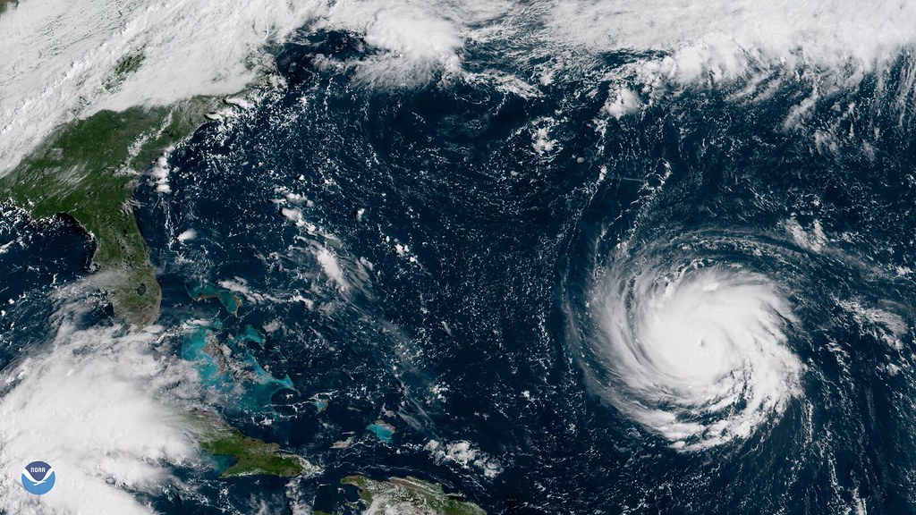
Ten days ago, Hurricane Polo was a modest tropical storm off Mexico’s Pacific coast. By September 22, it had exploded into a Category 5 hurricane with sustained winds of up to 180 mph. That made it the second-strongest hurricane on record in the Eastern Pacific basin. The Hurricane Polo Mexico landfall that followed has triggered evacuations, school closures and flood watches. Those now stretch far beyond the coastline where the storm first hit.
Polo’s rapid intensification, gaining more than 100 mph in wind speed in roughly 24 hours, caught many forecasters off guard. It gave coastal communities in Baja California Sur only a short window to prepare.
The Hurricane Polo Mexico landfall, step by step
By the time Polo reached the coast, it had weakened considerably from its Category 5 peak. CBS News reported the storm made its first landfall in Baja California Sur as a strong Category 2 hurricane, with maximum sustained winds of 110 mph. It then weakened further, to Category 1 strength with 80 mph winds. Mexican authorities expected a second landfall in southern Sonora on the mainland shortly afterward.
Even at reduced strength, the storm carried enough moisture to trigger serious flooding concerns. The U.S. National Hurricane Center forecast 6 to 12 inches of rainfall across Baja California Sur. Sonora was forecast to see 4 to 6 inches, and locally up to 8 inches.

Evacuations, shelters and school closures
Mexican authorities evacuated residents from vulnerable coastal areas, opened emergency shelters, and deployed military personnel ahead of the storm’s arrival, according to CBS News. Schools suspended classes in Acapulco as a precaution, even though the city sits well away from Polo’s direct path. That step alone shows how seriously officials treated the storm’s potential for widespread disruption.
Hurricane warnings were issued for parts of Baja California Sur and for a stretch of mainland Mexico running from Bahia Kino to Huatabampito. Tropical storm warnings covered both coasts of Baja California Sur as well as additional sections of the mainland.
A flood threat that reaches deep into the United States
Polo’s remnants are forecast to continue moving north into the southwestern United States. The National Weather Service has issued flood watches across 11 U.S. states, including Arizona, New Mexico, Utah, Colorado, Kansas, Nebraska, Iowa and Texas. Yale Climate Connections reported the flood threat extends from the Four Corners region eastward into the Central Plains. That puts more than 14 million Americans within the affected area.
That reach illustrates a pattern that has become increasingly common with Pacific hurricanes in recent years. A storm can weaken well below hurricane strength at the coast and still deliver its most dangerous impacts hundreds of miles inland. Those impacts usually take the form of flash flooding rather than wind damage.
What happens as Polo moves north
Forecasters will be watching how much of Polo’s moisture survives the journey north. They are also tracking how it interacts with existing weather patterns over the southwestern U.S. Local officials in the affected states are urging residents in flood-prone areas to monitor forecasts closely over the coming days. Low-lying and canyon terrain, where flash flooding can develop with little warning, carries the greatest risk.
Why Polo’s intensification matters beyond this storm
Polo jumped from a 45 mph tropical storm on September 21 to 150 mph winds by the next day. That kind of rapid intensification has become a growing focus for climate scientists. They are studying how warming ocean temperatures affect storm behavior. Faster intensification gives coastal communities less time to prepare, a pattern forecasters have flagged in several major storms in recent hurricane seasons.
FAQ: Hurricane Polo and travel to Mexico
Did Hurricane Polo make landfall as a Category 5 storm?
No. Polo peaked at Category 5 strength on September 22 while still offshore, then weakened before making landfall in Baja California Sur as a Category 2 storm with 110 mph winds, later dropping to Category 1 strength.
Which parts of Mexico were affected?
Baja California Sur took the first landfall, with a second landfall expected in southern Sonora on the mainland. Hurricane warnings covered Baja California Sur and the mainland coast from Bahia Kino to Huatabampito.
Which US states are under flood watches because of Polo?
The National Weather Service issued flood watches across 11 states, including Arizona, New Mexico, Utah, Colorado, Kansas, Nebraska, Iowa and Texas, as the storm’s remnants moved north.
How many people are at risk from flooding?
Yale Climate Connections reported the flood threat, stretching from the Four Corners region into the Central Plains, affects more than 14 million Americans.
Were there any casualties reported from Hurricane Polo?
As of the most recent reporting, no casualties or damage figures had been confirmed, though evacuations and shelter openings were underway in Mexico ahead of landfall.
Is it safe to travel to Los Cabos or Baja California Sur right now?
Travelers should check official advisories and airline notices before departure, since coastal areas of Baja California Sur were under direct hurricane and tropical storm warnings at the time of landfall.
More travel coverage
Sources for this report
- CBS News — Hurricane Polo makes landfall over Mexico. See its path. cbsnews.com
- Yale Climate Connections — After two landfalls in Mexico, Hurricane Polo’s rainmaking journey has just begun. yaleclimateconnections.org